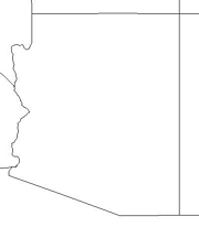
Click for printable map of Arizona
(Browse all the other World Maps.)
Map of Arizona links to other maps
- Canyon de Chelly National Monument (PDF)
- Chiricahua National Monument (PDF)
- Coronado National Memorial (PDF)
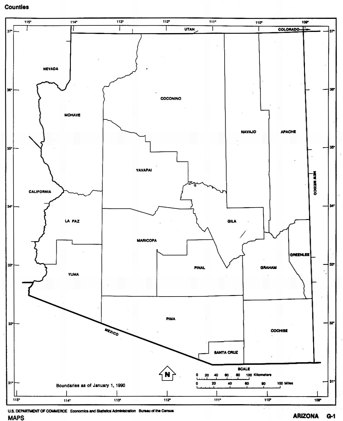
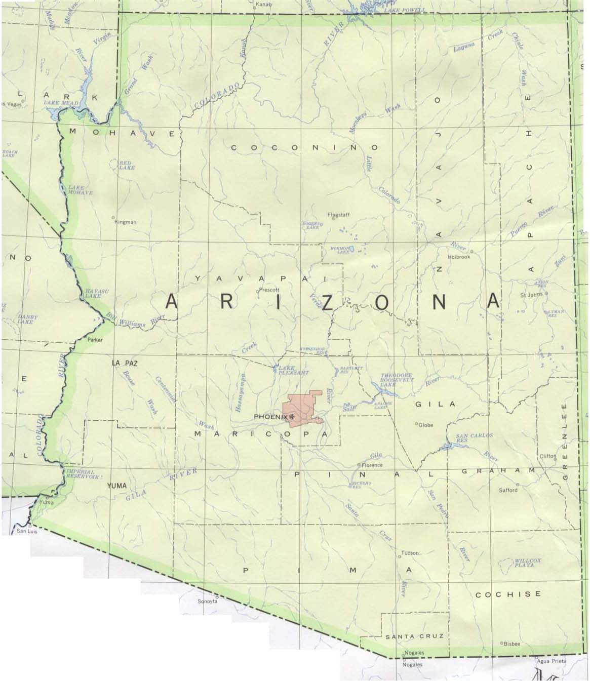
- County boundaries and names (click on the map to enlarge)
- Federal Lands and Indian Reservations (PDF)
- Fort Bowie National Historic Site (PDF)
- Glen Canyon National Recreation Area [Arizona / Utah] (click on the map to enlarge)
- Historical(1917 – click on the map to enlarge)
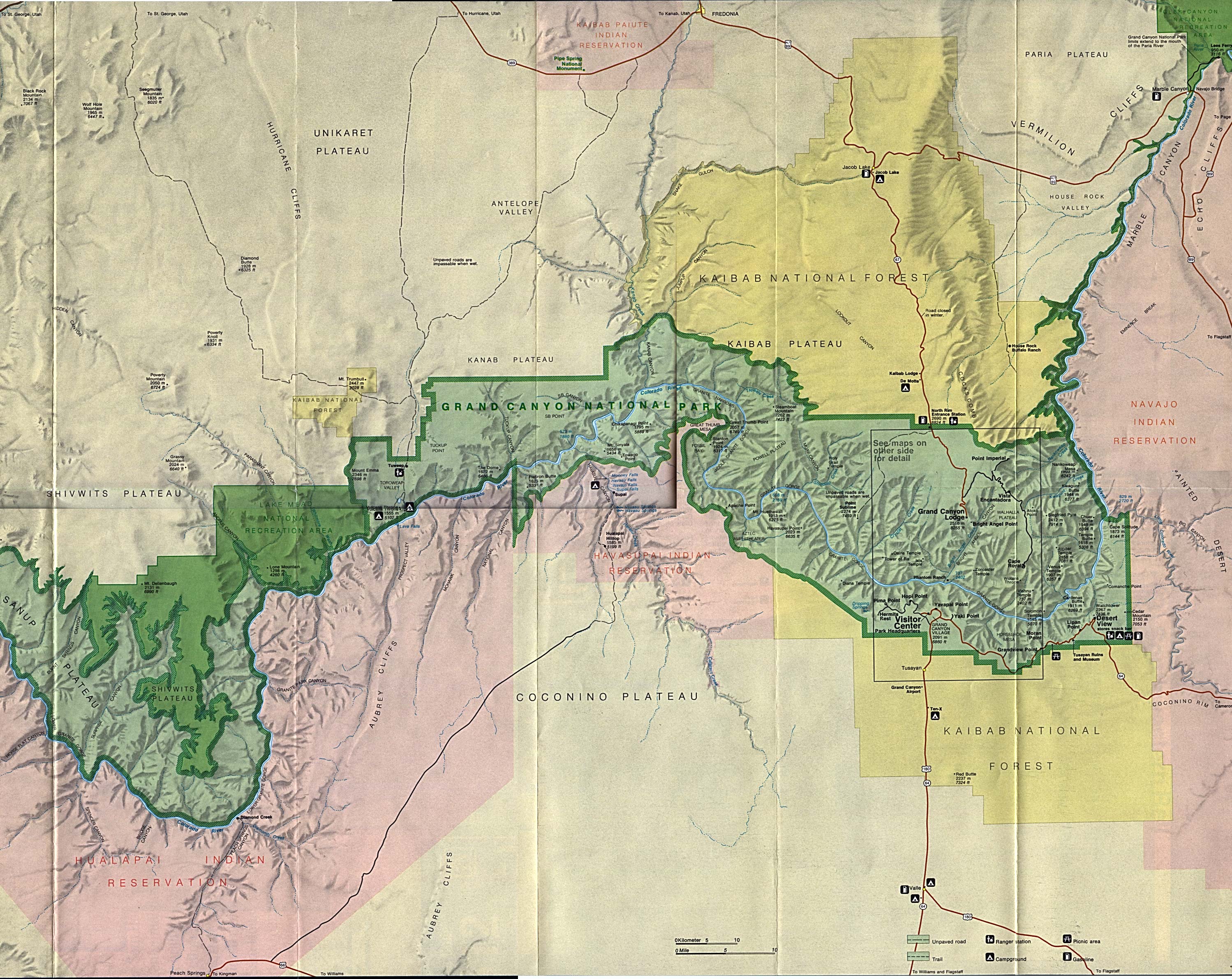
- Grand Canyon National Park (PDF)
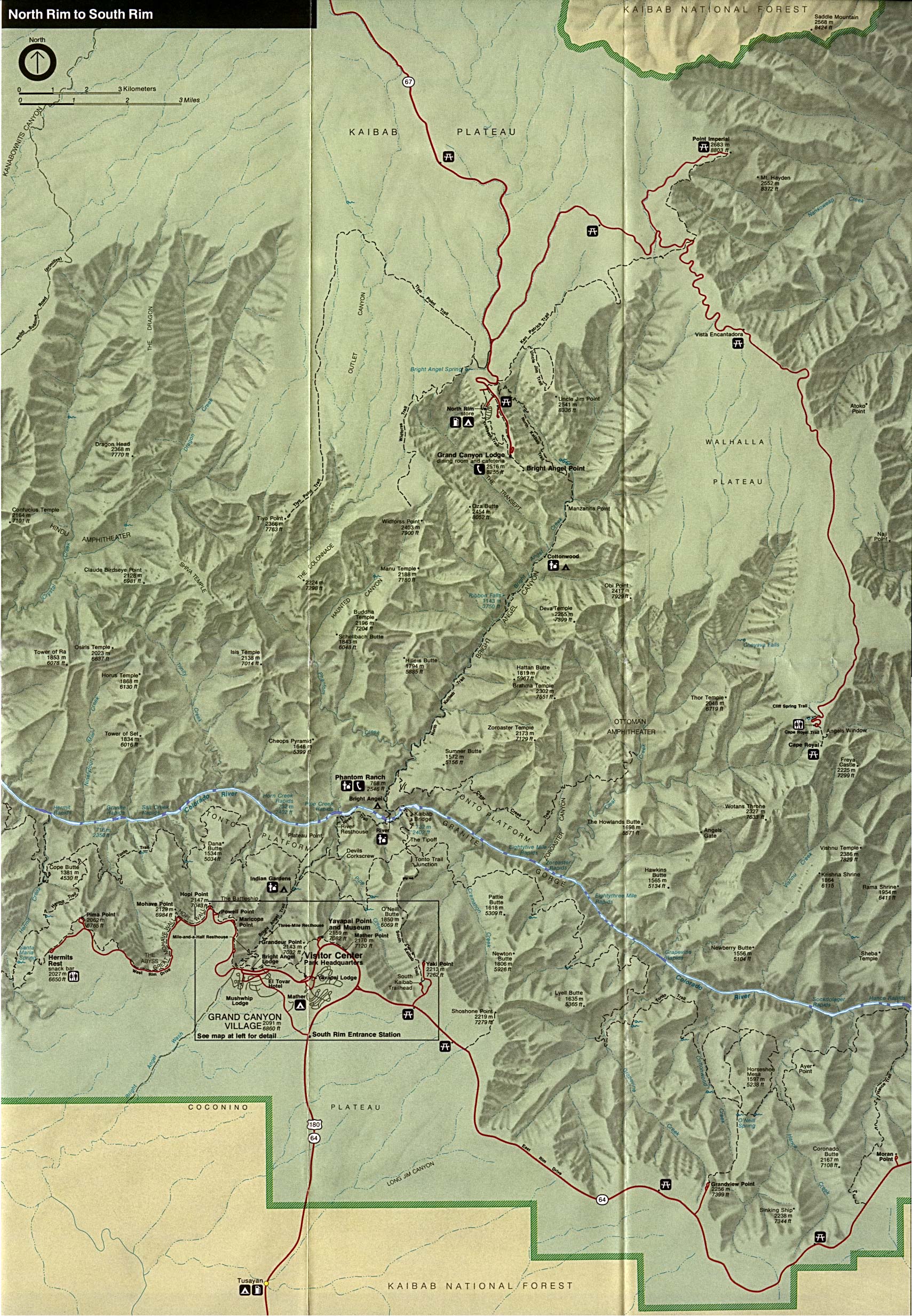
- Grand Canyon National Park – Eastern Area (click on the map to enlarge)
- Grand Canyon National Park – Western Area (click on the map to enlarge)
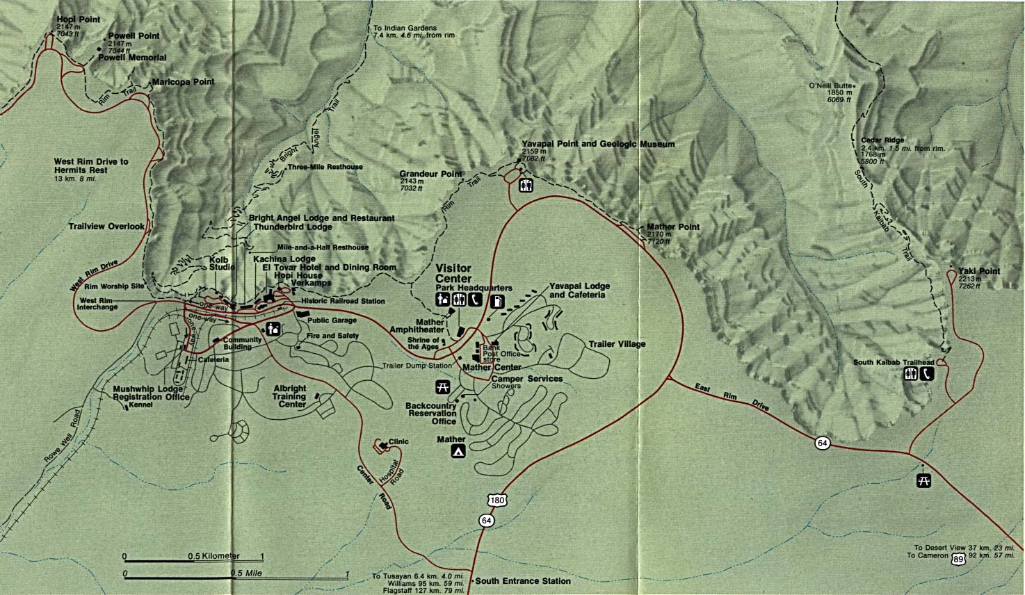
- Grand Canyon National Park – Grand Canyon Village (click on the map to enlarge)
- Organ Pipe Cactus National Monument (PDF)
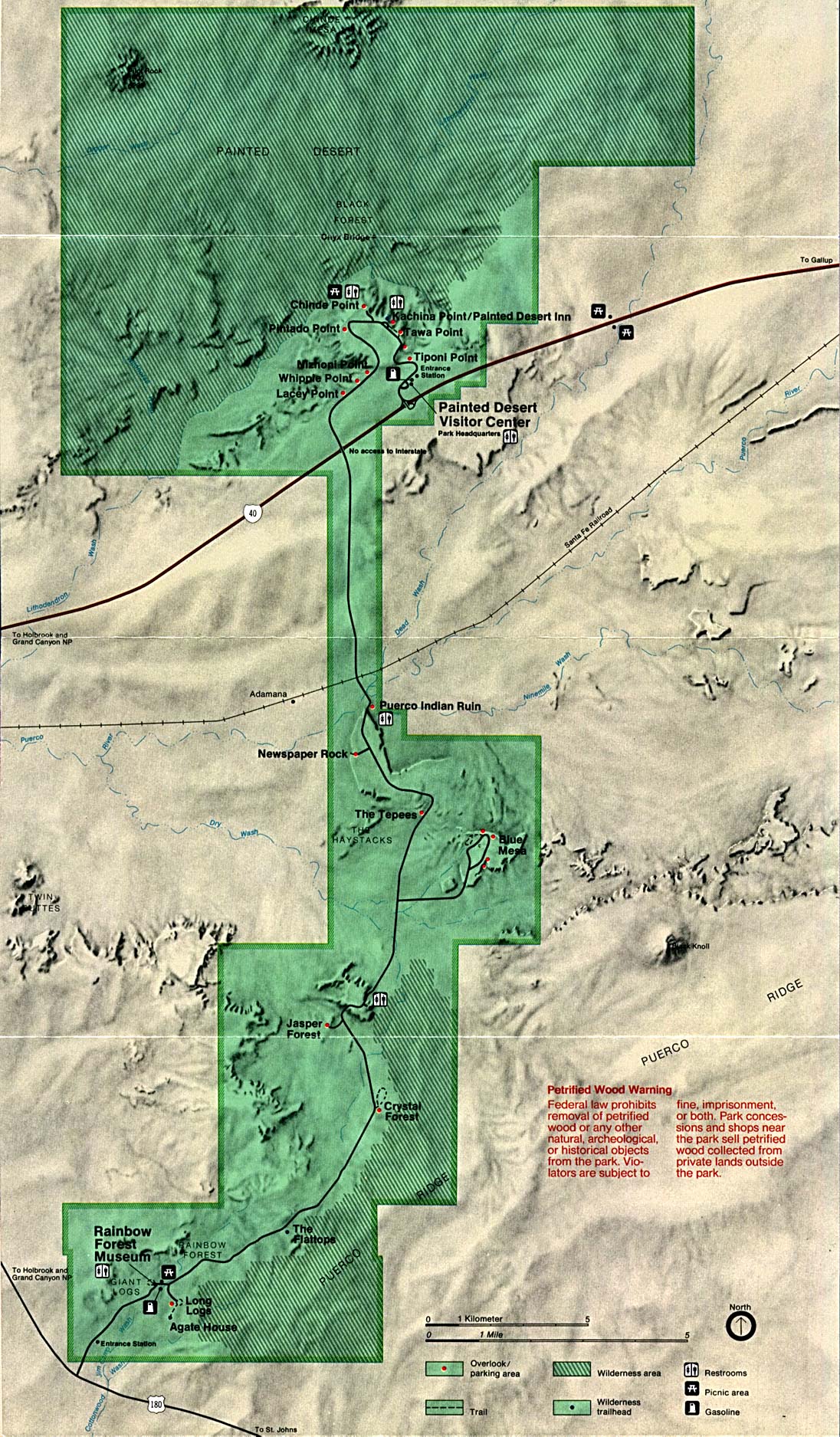
- Petrified Forest National Park (click on the map to enlarge)
- Petrified Forest National Park (Same as above, but as a PDF)
- Political (click on the map to enlarge)
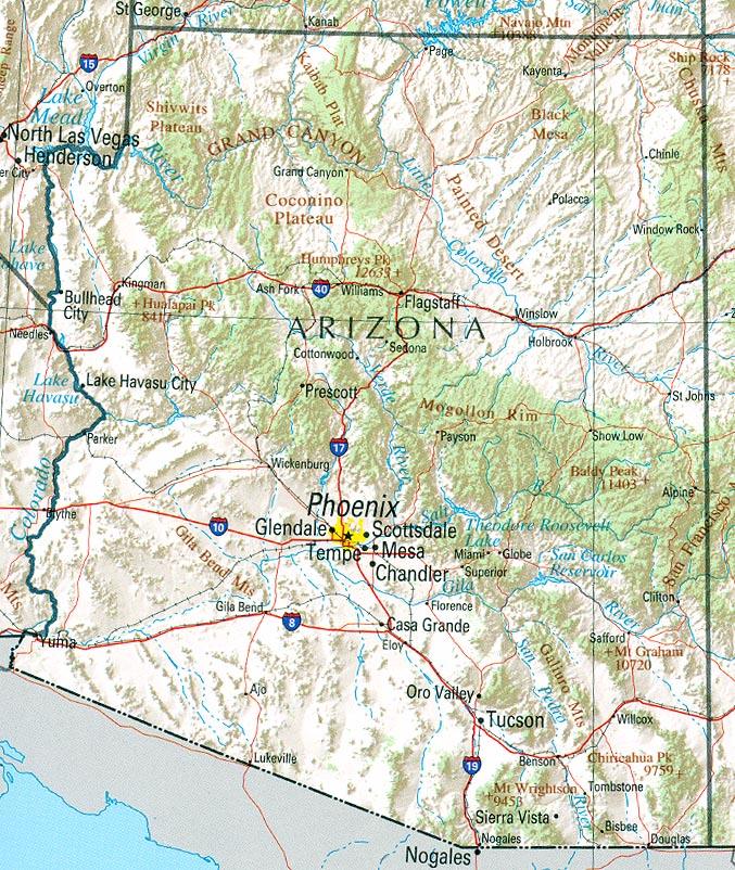
- Reference map (click on the map to enlarge)
- Reference map – Same as above, but as a PDF
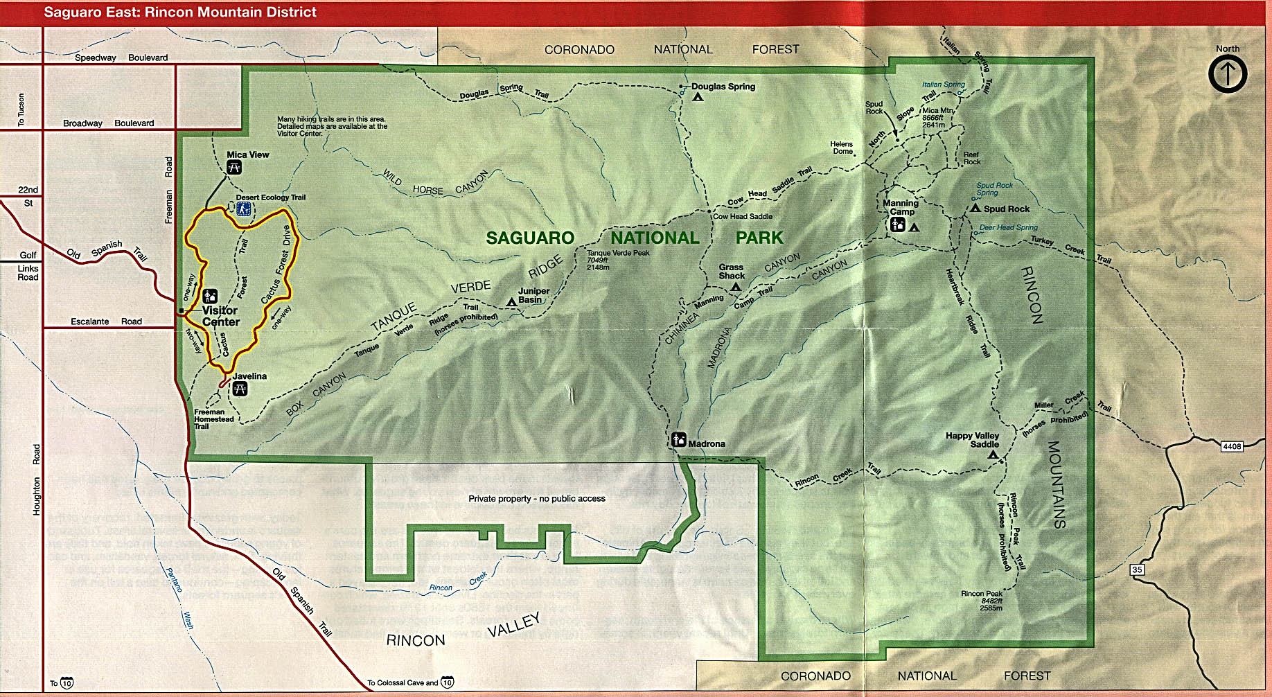
- Saguaro National Park (East: Rincon Mountain District) (click on the map to enlarge)
- Saguaro National Park (East: Rincon Mountain District) – Same as above, but as a PDF
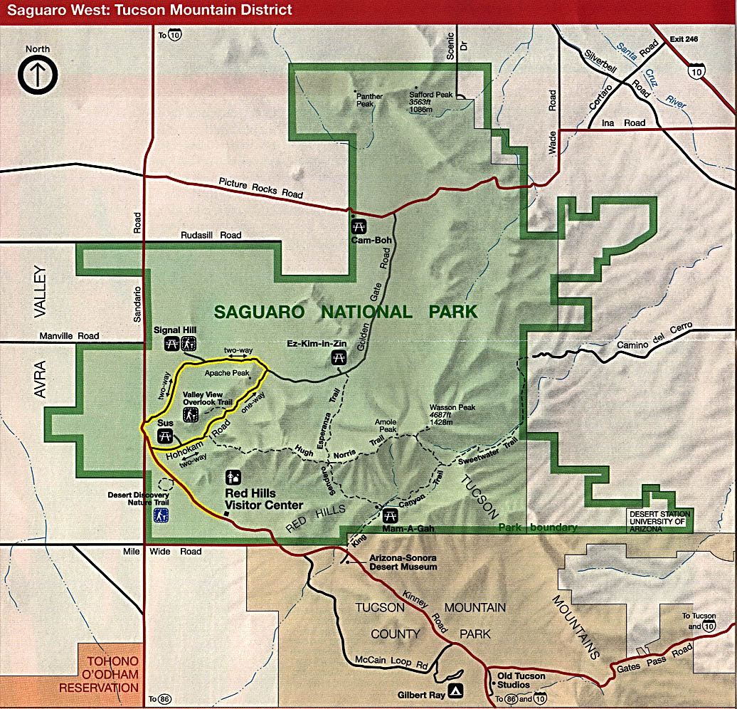
- Saguaro National Park (West: Tucson Mountain District) (click on the map to enlarge)
- Saguaro National Park (West: Tucson Mountain District) – Same as above, but as a PDF
- Wupatki National Monument (PDF)
- Arizona State Parks Map
- Arizona Railroads Map – (PDF)
- Arizona Airports Map – Map showing Commercial and Military airports (PDF)
- Arizona Reservations Map – Map showing American Indian Reservations in Arizona (PDF)
- Arizona State Highway System Map – (PDF)
![Glen Canyon National Recreation Area [Arizona / Utah]](http://www.lib.utexas.edu/maps/national_parks/glen95.jpg)
Downloadable
- Blank Outline Map – A printer-friendly document.
- Roads – You can zoom in and print your own maps at a large scale.
For purchase
- Rand McNally Arizona Travel Map – Durable laminated folding highway map
- Arizona Wall Map – A beautiful shaded relief and tinted elevation wall map available in plain paper or laminated.
- Click Here for other Arizona maps.
Arizona Of Interest
The early explorer Francisco Vásquez de Coronado entered what is now known as Arizona in 1540. The area remained under Spanish and later Mexican rule until the Mexican War, starting in 1846. A traveler named Joseph Ives, in describing the Grand Canyon in 1857, said “…Ours has been the first and will doubtless be the last party of whites to visit this profitless locality.”
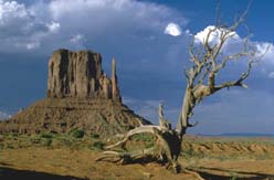
Annually, nearly 5 million people visit the Grand Canyon, one of the world’s greatest natural wonders. The southern half of the state is mostly desert interrupted by mountains reaching northwest to southeast across the central part of the state. The Gila River, a major tributary of the Colorado, flows west across the all of Arizona. The state shares the largest artificial body of water in the nation, Lake Mead, with Nevada.
There were over 200,000 Native Americans in Arizona according to the 1990 census. That was almost 6% of the state’s population, the third highest such concentration in the United States. They include Mohave, Navajo, Apache, Hopi, Yavapaí, Hualapai, Havasupai, Paiute, Tohono O’Odham, Pima, and Maricopa. Poverty is prevalent among these peoples. Agriculture is the mainstay of their economy, but lack of water for irrigation makes farming challenging. Supplemental income is made through the production of handicrafts. These include turquoise jewelry, leather goods, pottery, and woven items. Tourism and mineral rights have also brought income to the tribes.
See related information at United States Maps
Browse all the other World Maps.