A GIS software is a system designed to capture, store, manipulate, analyze, manage and present all types of geographically referenced data, in order to be used in different fields of interest. If you know of any additions or corrections to be made, please let me know. This list is current as of October 12, 2012.
(Browse all the other GPS articles and features.)
The list is now sorted as to operating system – choose below.
| Windows | Linux/Unix |
| Mac | Mobile devices |
• See a complete list of free GPS software here.
• See a complete list of free GPS maps here.
• See a complete list of free geocaching software here.
The most recently added programs for Windows, Linux/Unix, Mac and Mobile devices:
September 13 – QLandkarte GT for Windows, Linux and Mac
May 9 – Mapwithus GIS for Mobile Devices
May 9 – MyGIS for Mobile Devices
May 9 – GISRoam for Mobile Devices
Browse all the other GPS articles and features.
Free GIS Software
for Windows desktop and notebook
operating systems
ArcExplorer is the Java based free data viewer from ESRI. This program allows you to view and geocode data in shapefile format.
ArcGIS Explorer is a free GIS viewer that gives you an easy way to explore, visualize, and share GIS information.
ArcReader is a free, easy-to-use desktop mapping application that allows users to view, explore, and print maps and globes.
AutoDEM (aka as AutoMNT) is a freeware GIS software to create Digital Elevation Models (DEM) from scanned topographic maps for Windows.
AvisMap Free Viewer is a new tool for data browse in AvisMap GIS 5, which used for browse map data produced by different kinds of AvisMap GIS products.
Capaware is conceived as a system of 3D terrain representation with multilayer representation of diverse types of resources capabilities and executed applications integration feature.
CartoMAP Pro is a FREE Viewer that supports both MapInfo Mif/Mid and ArcView Shape files.
Christine-GIS Viewer is free GIS software allows you viewing and spatial querying vector and raster data, creating and editing tabular data, connect DBMS by ODBC, creating applications by integrated script language.
DIVA-GIS is a free computer program for mapping and geographic data analysis (a geographic information system (GIS).
Elshayal Smart is capable of developing GIS Standalone applications that Create & Edit & Publish Shape and Data base files and works on PC ,or Internet Server , or on smart devices like PDAs, and Pocket PCs.
FalconView is a PC based Mapping Application developed by the Georgia Tech Research Institute for the Department of Defense.
Flowmap is a software package dedicated to analyzing and displaying interaction or flow data.
GeoGenesis LITE is a free geospatial data viewer providing satellite and aerial photo imagery, elevation, and vector data display with an easy to use graphical user interface.
Geomatica FreeView is a flexible data viewing tool supporting over 100 raster and vector formats for loading, viewing, selection, and enhancement. FreeView is useful for any geospatial data viewing application, and is freely distributable.
GeoMedia Viewer is an easy to use, FREE GIS software application for desktop viewing and distribution of geospatial data.
Geospatial Explorer has been written to enable geologists, environmental scientists, and engineers to apply innovative science and technology to enhance and expedite the reduction of risk to human health and the environment. Geospatial Explorer permits the user to identify, understand, and solve complex environmental problems better, faster, and cheaper.
GISVM is a free and ready to use anywhere Geographic Information System Virtual Machine, now available in three main versions: GISVM desktop, GISVM base and GISVM server.
GMT is an open source collection of ~65 tools for manipulating geographic and Cartesian data sets (including filtering, trend fitting, gridding, projecting, etc.) and producing Encapsulated PostScript File (EPS) illustrations ranging from simple x-y plots via contour maps to artificially illuminated surfaces and 3-D perspective views; the GMT supplements add another ~70 more specialized tools.
GRASS is a free Geographic Information System (GIS) software used for geospatial data management and analysis, image processing, graphics/maps production, spatial modeling, and visualization. GRASS is currently used in academic and commercial settings around the world, as well as by many governmental agencies and environmental consulting companies.
gvGIS is a Geographic Information System (GIS), that is, a desktop application designed for capturing, storing, handling, analyzing and deploying any kind of referenced geographic information in order to solve complex management and planning problems.
ILWIS (Integrated Land and Water Information System) is a remote sensing and GIS software which integrates image, vector and thematic data in one unique and powerful package on the desktop.
JUMP is a GUI-based application for viewing and processing spatial data. It includes many common spatial and GIS functions. It is also designed to be a highly extensible framework for developing and running custom spatial data processing applications.
Kalypso is an open source application for geospatial modelling and simulation. It is primarily developed to be a user friendly tool for GIS-based modelling and simulation of hydrological and hydraulic numerical models.
LandSerf is a freely available Geographical Information System (GIS) for the visualisation and analysis of surfaces. Applications include visualisation of landscapes; geomorphological analysis; gaming development; GIS file conversion; map output; archaeological mapping and analysis; surface modelling and many others.
MapWindow is a ready-to-use spatial data viewer, and a tool that can be modified into a new custom application. Customization is done by editing the MapWindow Configuration File, and/or a MapWindow Project File.
Minerva is an open-source program for viewing geospatial data that works on Windows, Mac, and Linux. It unifies standard GIS capabilities with high-performance, 3D visualization.
MultiSpec is used for analyzing multispectral and hyperspectral image data, and to transfer this technology to the user community in as rapid a manner as possible.
Natural Resources Database (NRDB) is a free database and mapping application for developing and distributing environmental databases. It was designed to provide people in developing countries with a powerful yet simple tool to assist in the managing of their own resources.
OpenJUMP is an open source Geographic Information System that can read and write shapefiles and simple GML files.
OpenMap is a Java Beans based toolkit for building applications and applets needing geographic information. Using OpenMap components, you can access data from legacy applications, in-place, in a distributed setting.
OrbisGIS is a Geographical Information System (GIS) dedicate to scientific modeling and simulation.
PC-GIS 3.2 is a lightweight GIS software solution for MS Windows. PC-GIS 3.2 is perfect for educational use in High Schools and Colleges. It is an easy-to-learn and friendly-to-use introduction to GIS.
QLandkarte GT is a powerful Open Source GIS application to display your GPS data on a variety of maps. It’s target is the less the scientific user but the private outdoor aficionado with a crush on hightech equipment.
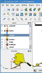
Quantum GIS (QGIS) is a user friendly Open Source Geographic Information System (GIS) licensed under the GNU General Public License. QGIS is an official project of the Open Source Geospatial Foundation (OSGeo). It runs on Linux, Unix, Mac OSX, and Windows and supports numerous vector, raster, and database formats and functionalities.
SAGA the abbreviation for System for Automated Geoscientific Analyses and has been designed for an easy and effective implementation of spatial algorithms.
Shape Viewer is a free tool, which you can use to view ESRI Shape files.
SPRING is a state-of-the-art GIS and remote sensing image processing system with an object-oriented data model which provides for the integration of raster and vector data representations in a single environment.
TatukGIS Viewer is a free desktop GIS Viewer, which is a slimmed-down version of TatukGIS Editor.
TdhGIS performs spatial analysis of data based on vector defined geometric data.
TerraView is a GIS application built using the TerraLib GIS library. TerraView main goal is to make available to the GIS Community an easy geographic data viewer with resources that include database queries and data analysis, exemplifying the use of the TerraLib library.
Thuban is an Interactive Geographic Data Viewer with the following features: Vector Data Support (Shapefile, PostGIS Layer), Raster Data Support (GeoTIFF Layer), Comfortable Map Navigation, Object Identification and Annotation, Legend Editor and Classification.
TNTatlas is a free product from MicroImages for viewing hierarchical atlases prepared in TNTmips with HyperIndex Linker, or for single-layout atlases.
TNTmips Free is a large, full-featured geospatial analysis software package, except that the license to use it free-of-charge limits the size, number, and complexity of the geodata layers you can use in your project.
uDig is an open source (LGPL) desktop application framework, built with Eclipse Rich Client (RCP) technology.
Whitebox GAT is an exciting new open-source GIS project. Whitbox is as much a philosophical approach to geomatics as it is a GIS/Remote Sensing package.
Browse all the other GPS articles and features.
Free GIS Software
for Linux/Unix
DLGVU is an interactive viewer for Unix, written in the Icon programming language. It reads DLG files to produce maps.
FMaps is the ultimate open source GIS/RS mapping application.
GISVM is a free and ready to use anywhere Geographic Information System Virtual Machine, now available in three main versions: GISVM desktop, GISVM base and GISVM server.
GMT is an open source collection of ~65 tools for manipulating geographic and Cartesian data sets (including filtering, trend fitting, gridding, projecting, etc.) and producing Encapsulated PostScript File (EPS) illustrations ranging from simple x-y plots via contour maps to artificially illuminated surfaces and 3-D perspective views; the GMT supplements add another ~70 more specialized tools.
gvGIS is a Geographic Information System (GIS), that is, a desktop application designed for capturing, storing, handling, analyzing and deploying any kind of referenced geographic information in order to solve complex management and planning problems.
LandSerf is a freely available Geographical Information System (GIS) for the visualisation and analysis of surfaces. Applications include visualisation of landscapes; geomorphological analysis; gaming development; GIS file conversion; map output; archaeological mapping and analysis; surface modelling and many others.
Minerva is an open-source program for viewing geospatial data that works on Windows, Mac, and Linux. It unifies standard GIS capabilities with high-performance, 3D visualization.
OpenJUMP is an open source Geographic Information System that can read and write shapefiles and simple GML files.
OpenMap is a Java Beans based toolkit for building applications and applets needing geographic information. Using OpenMap components, you can access data from legacy applications, in-place, in a distributed setting.
OrbisGIS is a Geographical Information System (GIS) dedicate to scientific modeling and simulation.
QLandkarte GT is a powerful Open Source GIS application to display your GPS data on a variety of maps. It’s target is the less the scientific user but the private outdoor aficionado with a crush on hightech equipment.
Quantum GIS (QGIS) is a user friendly Open Source Geographic Information System (GIS) licensed under the GNU General Public License. QGIS is an official project of the Open Source Geospatial Foundation (OSGeo). It runs on Linux, Unix, Mac OSX, and Windows and supports numerous vector, raster, and database formats and functionalities.
SAGA the abbreviation for System for Automated Geoscientific Analyses and has been designed for an easy and effective implementation of spatial algorithms.
SPRING is a state-of-the-art GIS and remote sensing image processing system with an object-oriented data model which provides for the integration of raster and vector data representations in a single environment.
TdhGIS performs spatial analysis of data based on vector defined geometric data.
TerraView is a GIS application built using the TerraLib GIS library. TerraView main goal is to make available to the GIS Community an easy geographic data viewer with resources that include database queries and data analysis, exemplifying the use of the TerraLib library.
Thuban is an Interactive Geographic Data Viewer with the following features: Vector Data Support (Shapefile, PostGIS Layer), Raster Data Support (GeoTIFF Layer), Comfortable Map Navigation, Object Identification and Annotation, Legend Editor and Classification.
uDig is an open source (LGPL) desktop application framework, built with Eclipse Rich Client (RCP) technology.
Browse all the other GPS articles and features.
Free GIS Software
for Mac
ArcExplorer is the Java based free data viewer from ESRI. This program allows you to view and geocode data in shapefile format.
GISVM is a free and ready to use anywhere Geographic Information System Virtual Machine, now available in three main versions: GISVM desktop, GISVM base and GISVM server.
GMT is an open source collection of ~65 tools for manipulating geographic and Cartesian data sets (including filtering, trend fitting, gridding, projecting, etc.) and producing Encapsulated PostScript File (EPS) illustrations ranging from simple x-y plots via contour maps to artificially illuminated surfaces and 3-D perspective views; the GMT supplements add another ~70 more specialized tools.
gvGIS is a Geographic Information System (GIS), that is, a desktop application designed for capturing, storing, handling, analyzing and deploying any kind of referenced geographic information in order to solve complex management and planning problems.
LandSerf is a freely available Geographical Information System (GIS) for the visualisation and analysis of surfaces. Applications include visualisation of landscapes; geomorphological analysis; gaming development; GIS file conversion; map output; archaeological mapping and analysis; surface modelling and many others.
Minerva is an open-source program for viewing geospatial data that works on Windows, Mac, and Linux. It unifies standard GIS capabilities with high-performance, 3D visualization.
MultiSpec is used for analyzing multispectral and hyperspectral image data, and to transfer this technology to the user community in as rapid a manner as possible.
OpenJUMP is an open source Geographic Information System that can read and write shapefiles and simple GML files.
OpenMap is a Java Beans based toolkit for building applications and applets needing geographic information. Using OpenMap components, you can access data from legacy applications, in-place, in a distributed setting.
OrbisGIS is a Geographical Information System (GIS) dedicate to scientific modeling and simulation.
QLandkarte GT is a powerful Open Source GIS application to display your GPS data on a variety of maps. It’s target is the less the scientific user but the private outdoor aficionado with a crush on hightech equipment.
Quantum GIS (QGIS) is a user friendly Open Source Geographic Information System (GIS) licensed under the GNU General Public License. QGIS is an official project of the Open Source Geospatial Foundation (OSGeo). It runs on Linux, Unix, Mac OSX, and Windows and supports numerous vector, raster, and database formats and functionalities.
Thuban is an Interactive Geographic Data Viewer with the following features: Vector Data Support (Shapefile, PostGIS Layer), Raster Data Support (GeoTIFF Layer), Comfortable Map Navigation, Object Identification and Annotation, Legend Editor and Classification.
TNTatlas is a free product from MicroImages for viewing hierarchical atlases prepared in TNTmips with HyperIndex Linker, or for single-layout atlases.
TNTmips Free is a large, full-featured geospatial analysis software package, except that the license to use it free-of-charge limits the size, number, and complexity of the geodata layers you can use in your project.
uDig is an open source (LGPL) desktop application framework, built with Eclipse Rich Client (RCP) technology.
Browse all the other GPS articles and features.
Free GIS Software
for Mobile devices
ArcGIS allows you to navigate maps, collect and report data, and perform GIS analysis on your mobile phone.
eGIS Mobile is a free gis application that works on both iOS devices and Android devices.
GISRoam is a professional iPad based GIS data collection and data use platform.
iGIS represents a new era in mobile GIS solutions by enabling users to load, view, investigate, create and export their own spatial data over a background of Google Maps imagery.
JVNMobileGIS is a cross-platform mobile map viewer developed with Java ME technology. Support fetching map data from remote server to view on mobile device.
Magic GIS Lite is a free application to view shapefiles created by popular GIS software, and to edit the associated data that is held in the dbf file.
Mapwithus GIS provides innovative mobile and web-based Geographic Information System (GIS) solutions. This includes real-time location-based technology for acquiring, managing, mining, and sharing your data.
MyGIS – Manage your own map, with annotations and lines, and share it via twitter or emal. A simple but complete GIS system (add, move, delete and edit attributes).
Browse all the other GPS articles and features.