Click for printable map of Georgia
(Browse all the other World Maps.)
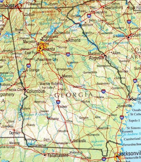
Map of Georgia links to other maps
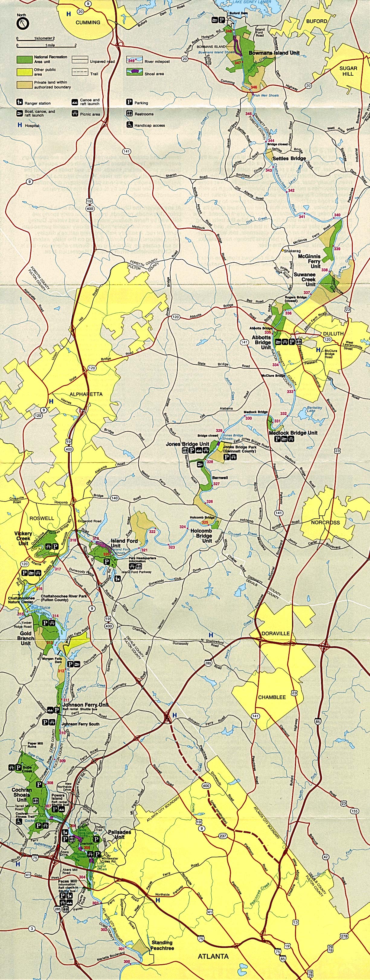
- Chattahoochee River National Recreation Area (click on the map to enlarge)
- Cumberland Island National Seashore (PDF)
- Federal Lands and Indian Reservations (PDF)
- Historical – A large selection of historical Georgia historical maps.
- Historical Maps
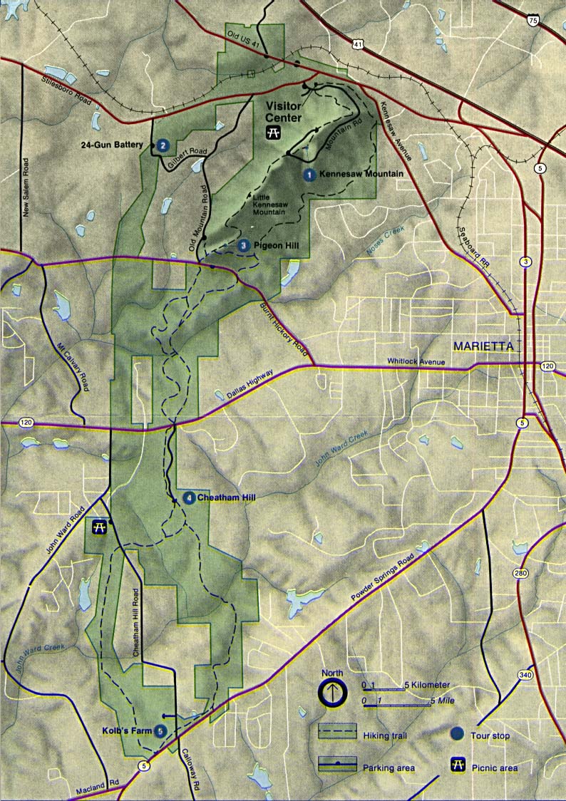
- Kennesaw Mountain National Battlefield Park (click on the map to enlarge)
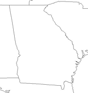
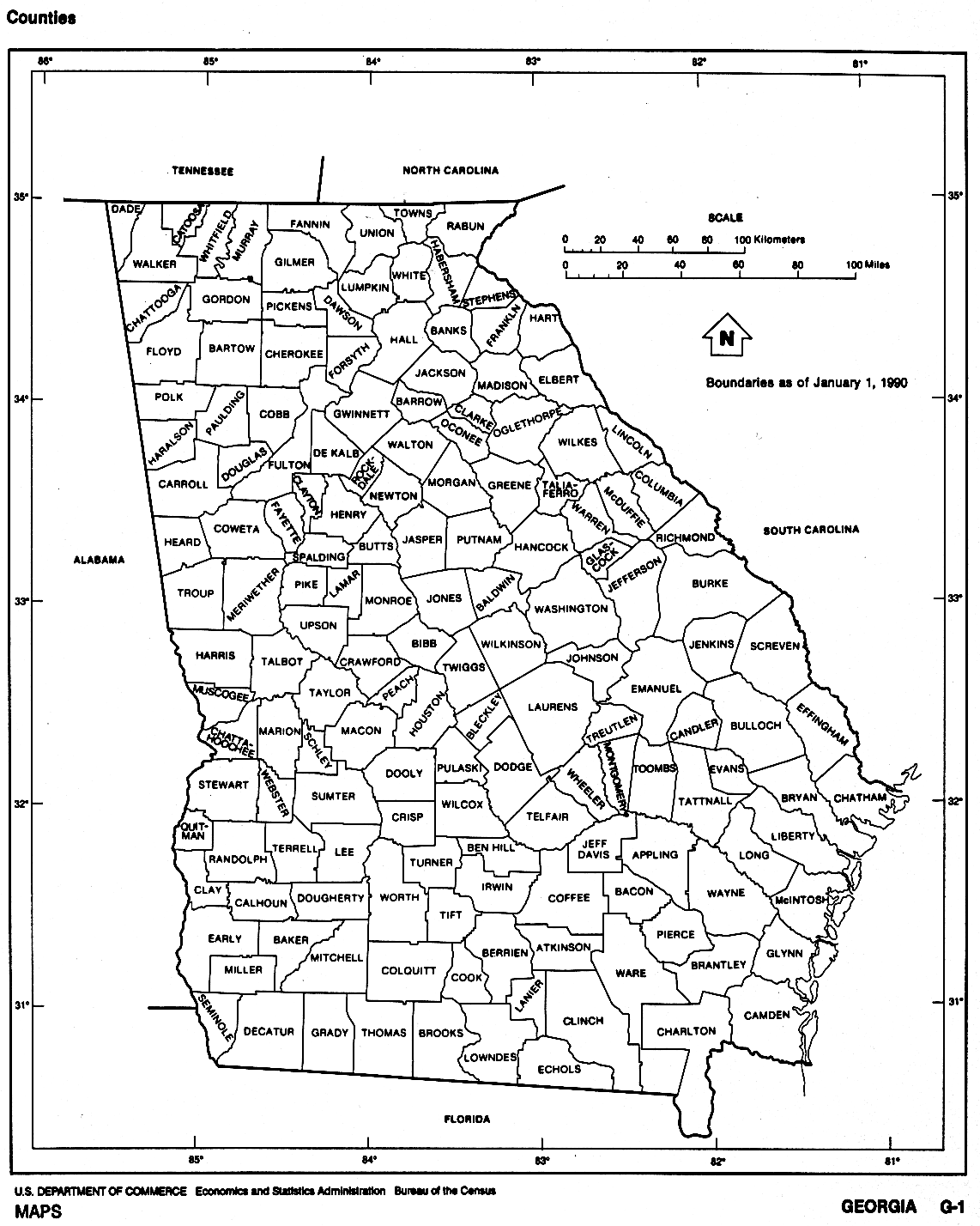
- Outline – counties labeled (click on the map to enlarge)
- Political (click on the map to enlarge)
- Reference (click on the map to enlarge)
- Shaded Relief A very detailed map (click on the map to enlarge)
- Official State Highway Map 2009-10 (PDF)
- USGS Basemap of Georgia (1:500,000) 72 dpi
- National forests in Georgia and contiguous states
- Georgia-county outlines with names (color)
- Georgia-county outlines with names (b&w gif file)
- Georgia-county outlines without names (hi-res b&w PDF file)
- Georgia Congressional Districts (PDF)
- Blank Outline Map with Capital
- Outline with Border States
- Highway and Road Map
- Physical Map
- Precipitation Map
Downloadable
- Blank Outline Map – A printer-friendly document.
- Roads – You can zoom in and print your own maps at a large scale.
- Shaded Relief – Can be printed at two different zoom levels (click on the map to zoom).
For purchase
- Folded, Free – A free highway map can be requested from this site.
- Georgia highway – A laminated, tear-proof folding highway map.
- Georgia Wall Map – A richly-colored shaded relief and elevation tinted map.
- GEORGIA County Wall Map – Several different sizes, laminated or plain papar.
- Click Here for other Georgia maps.
Georgia Of Interest
Explorer Hernando de Soto entered what is now Georgia in 1540. In 1733, James Oglethorpe first arrived at present-day Savannah and claimed the land he named Georgia in honor of King George of England. Georgia became a state in 1788. Dahlonega was the site of the nation’s first gold rush in 1828. The first steamship to cross the Atlantic was the City of Savannah and originated in Georgia.

Manufacturing and agriculture remain important to the state’s economy although the service and trade sectors create most of jobs in Georgia. Also contributing to the economy are federal facilities, such as Fort Benning, near Columbus; the Centers for Disease Control and Prevention, near Atlanta; and the Kings Bay naval base.
Cotton was once Georgia’s most important crop, but has since declined in importance giving way to tobacco, peanuts, and corn. Georgia is the nation’s largest producer of peanuts. Tobacco is the main crop in the southern two thirds of the state with peanuts occupying the southwest. The largest share of farm income is livestock and poultry raising. Cattle, eggs, and broilers are major products.
See related information at United States Maps
Browse all the other World Maps.