Learning how to read topo maps requires a little bit of practice. Elevations are represented by contour lines on a topo map. The vertical difference between any two contours is the contour interval. A map of a relatively flat area may have a contour interval of 10 feet or less. Maps in mountainous areas may have contour intervals of 100 feet or more.
To understand the contour line, think of it as an imaginary line on the ground which takes any shape necessary to maintain a constant elevation above or below a reference level, usually mean sea level. To picture this, imagine an ocean shoreline. Its contour is zero elevation. If the sea should rise and cover the land, the shoreline would trace, in turn, each of the contour lines shown on the map. If, for instance, the contour interval was 10 feet, the shoreline would coincide with a new contour each time the sea level rose 10 feet.
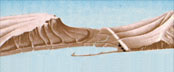
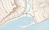
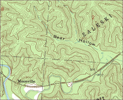
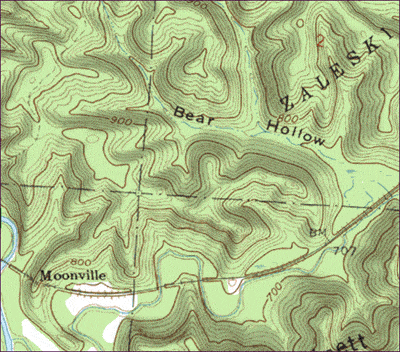
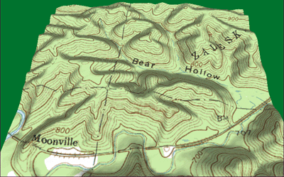
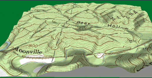
Once you get used to reading a topo map, you can visualize the landform by reading the map, as in the illustrations to the right. Visualizing landforms can allow you to determine whether a particular route is feasable. Visualizing can also help you match physical features you observe on the landscape with those on the map to aid in navigation. Because topo maps show a great variety of features, there is an extensive list of symbols. To see a complete list of symbols that will help you read topo maps, click here. This link opens a new browser window and when you get there, click on the list to enlarge it so you can read it.
The four illustrations below may also help you learn how to read a topo map. The first one is a screen shot of a topo map. The second one has relief shading added. The remaining two are various angles in 3D of the same area.
Return to Topo Home.