
Click for printable map of Colorado
(Browse all the other World Maps.)
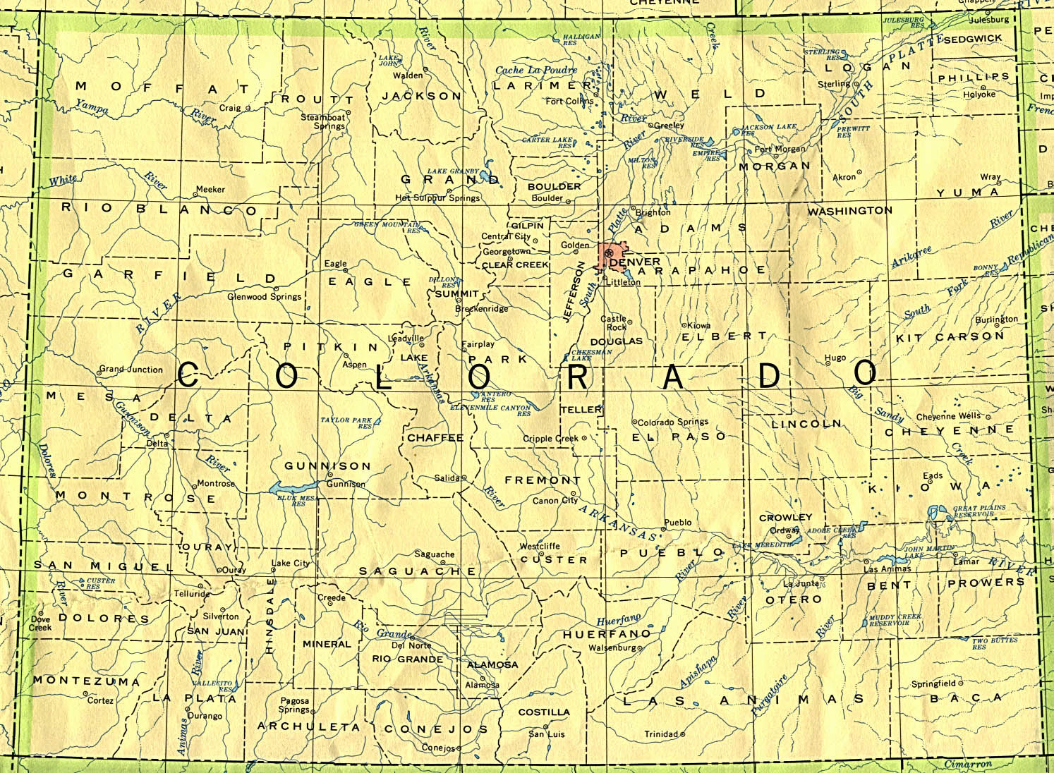
Map of Colorado links to other maps
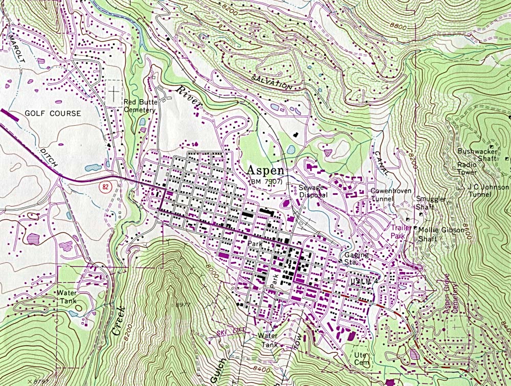
- Aspen (topo – click on the map to enlarge)
- Black Canyon of the Gunnison National Park (PDF)
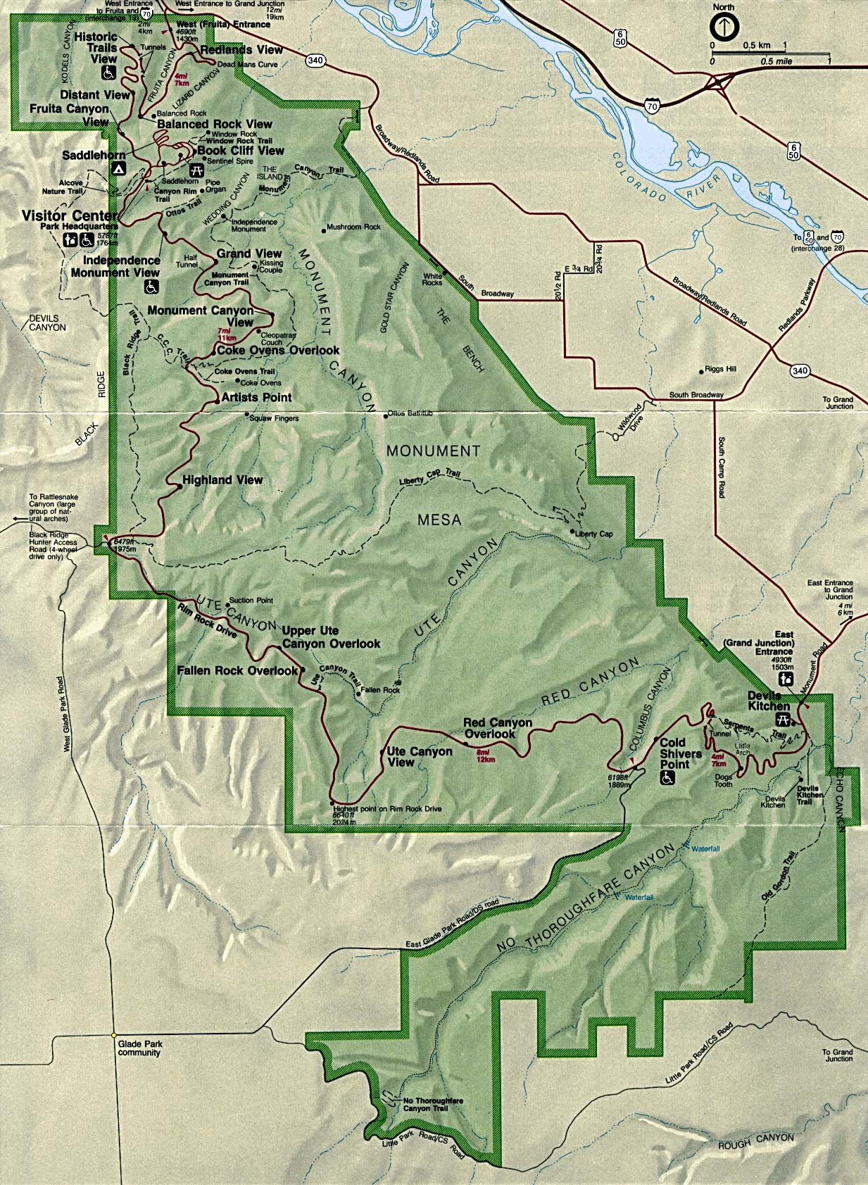
- Colorado National Monument (click on the map to enlarge)
- Cortez (topo – click on the map to enlarge)
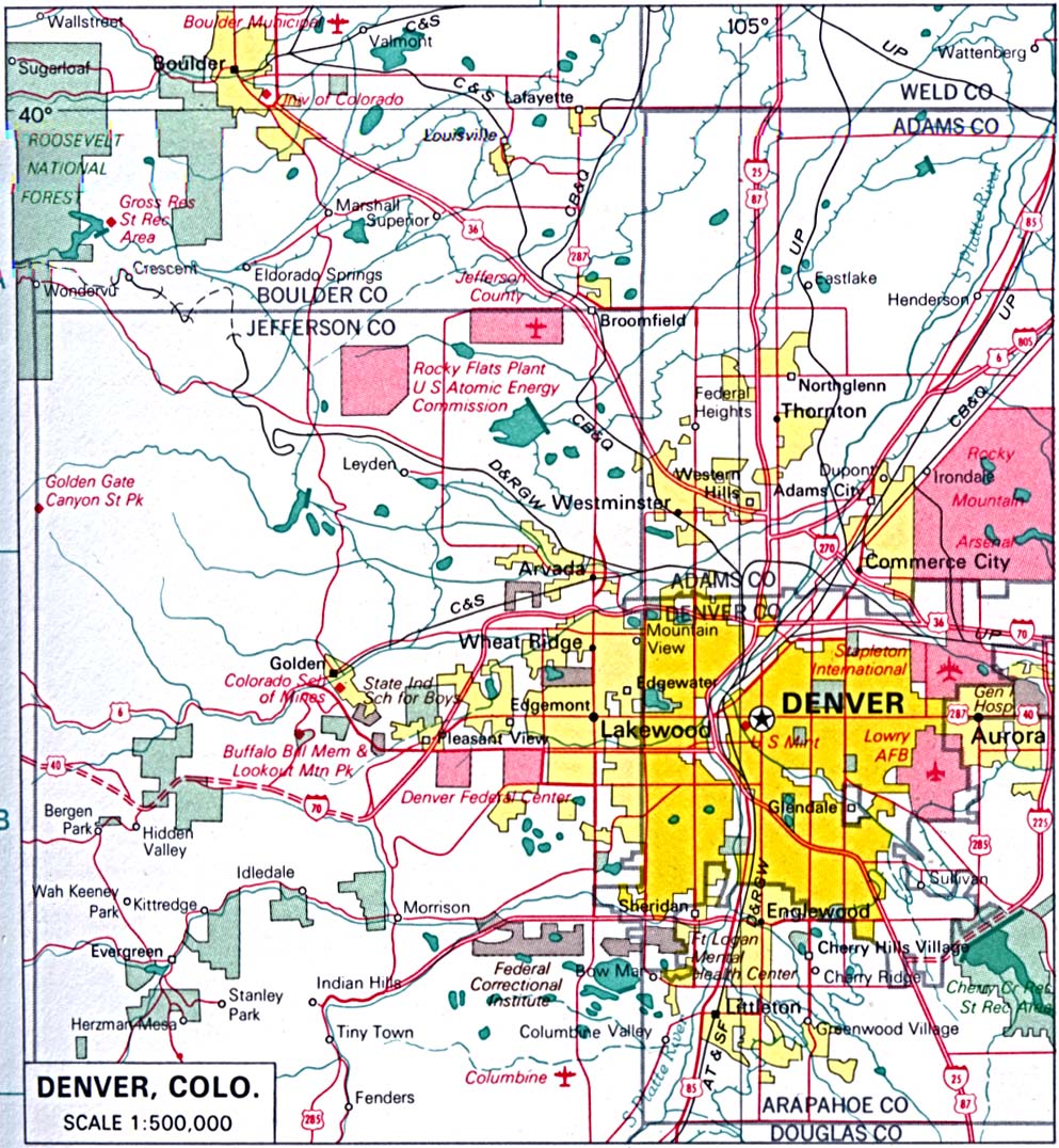
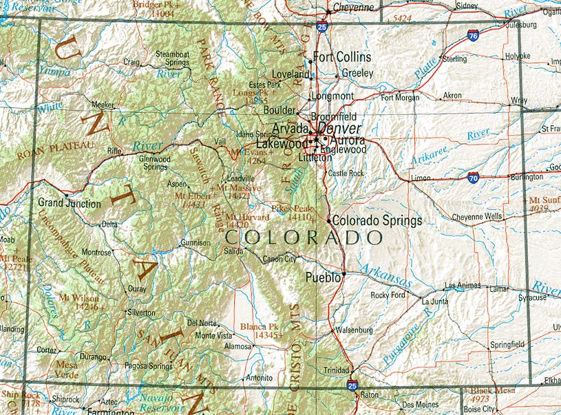
- Denver (click on the map to enlarge)
- Dinosaur National Monument [Colorado / Utah] (PDF)
- Federal Lands and Indian Reservations (PDF)
- Great Sand Dunes National Monument (PDF)
- Historical – a large collection of historical Colorado maps.
- Outline – counties (click on the map to enlarge)
- Political (click on the map to enlarge)
- Reference (click on the map to enlarge)
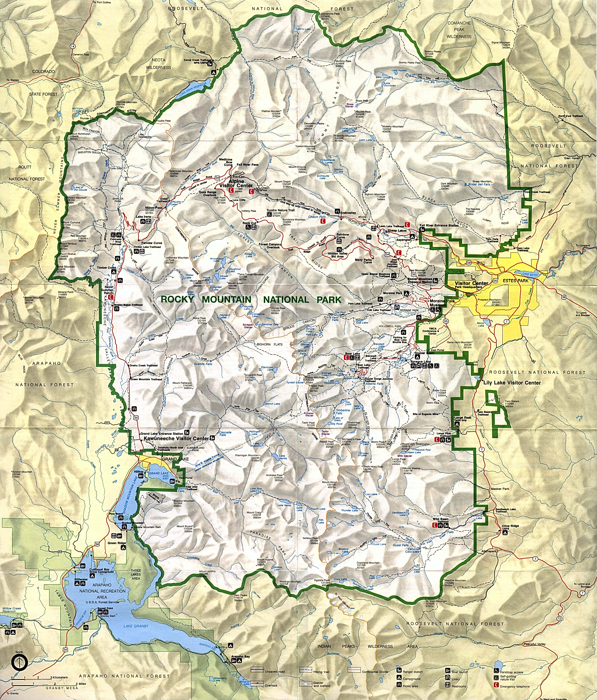
- Rocky Mountain National Park (click on the map to enlarge)
- Colorado State Map – (large PDF)
- Colorado State Parks Map
Downloadable
- Blank Outline Map – A printer-friendly document.
- Roads – You can zoom in and print your own maps at a large scale.
- Roads – A two-page PDF document showing major highways.
For purchase
- Highway, free – Fill out the form to request a map.
- Colorado highway – The Rand McNally laminated, tear-proof folding highway map.
- Colorado physical wall map – A beautiful shaded relief and tinted elevation wall map available in plain paper or laminated.
- For a large selection of other Colorado maps, click here.
Colorado Of Interest
Spanish explorers visited the Colorado region in the 16th century. Spain took ownership of the territory in 1763. In 1800 France acquired eastern Colorado and three years later the United States obtained it as part of the Louisiana Purchase. Western Colorado became U. S. territory in 1848 as a result of the Mexican War. It was made a state in 1876.
Colorado has more mountains of an altitude of 14,000 feet or more than any other state and has the highest mean altitude of the states. Included here is the world’s largest flat-topped mountain, Grand Mesa. Three of nation’s largest river systems originate in Colorado. At 1,053 feet over the Arkansas River, the highest suspension bridge in the world was built in 1929.
Important to the state’s economy is agriculture, especially the raising of cattle and sheep and production of dairy goods. The main farm crops are corn, wheat, hay, and sugar beets. Manufacturing has been the major source of income in the state since the 1950s. Others major industries include lumber, chemicals, the manufacture of electrical equipment, computer equipment, transportation equipment, and aerospace products. Also contributing to the economy are federal facilities such as army and air force bases, prisons, and the Denver Mint.
See related information at United States Maps
Browse all the other World Maps.