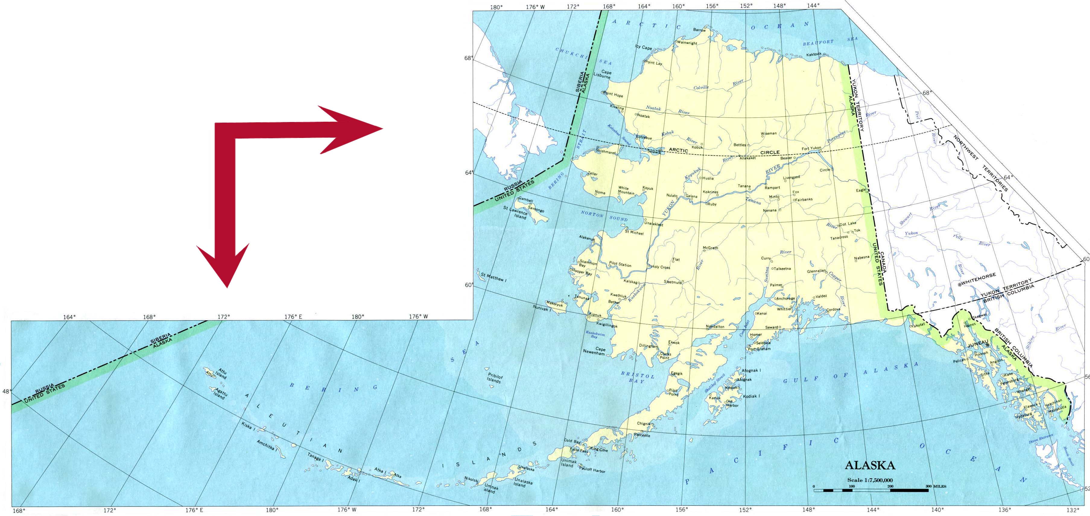
Click for printable map of Alaska
(Browse all the other World Maps.)
Map of Alaska links to other maps
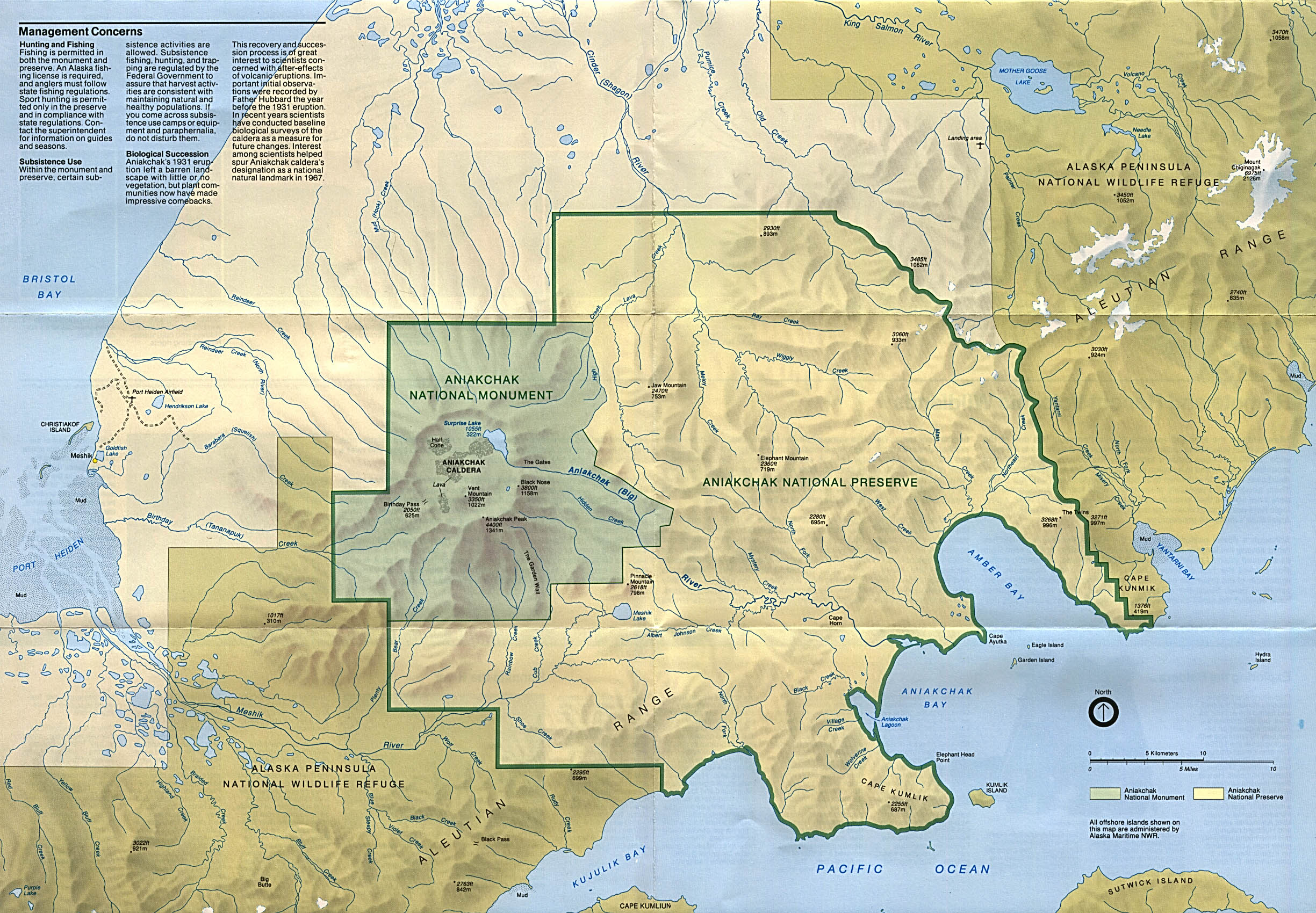
- Aniakchak National Monument and Preserve – (click on the map to enlarge)
- Bering Land Bridge National Preserve – (click on the map to enlarge)
- Cape Krusenstern National Monument – (click on the map to enlarge)
- Denali National Park and Preserve – (PDF)
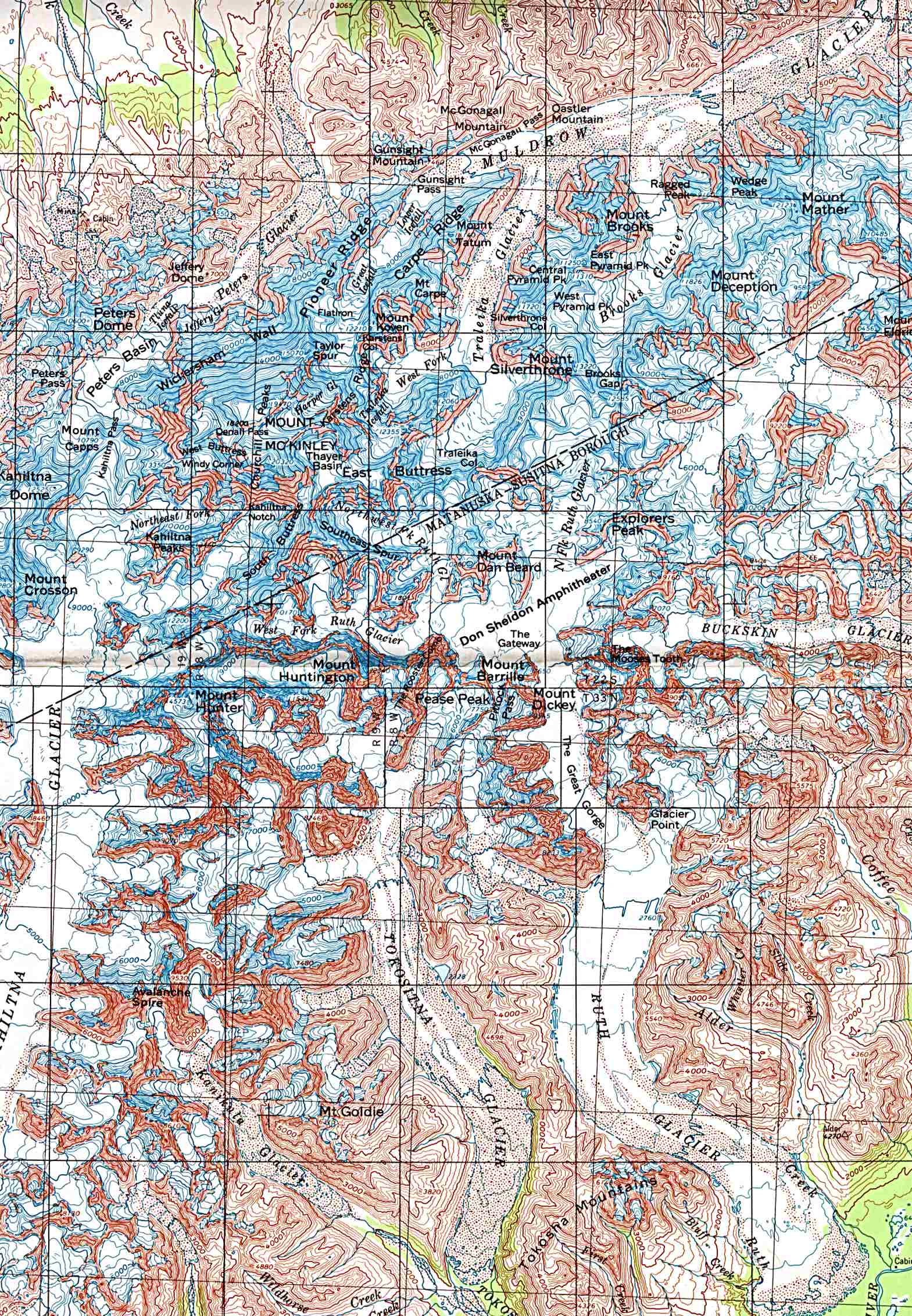
- Denali National Park and Preserve – Mount McKinley – (topo map – click on the map to enlarge)
- Federal Lands – A very large PDF file.
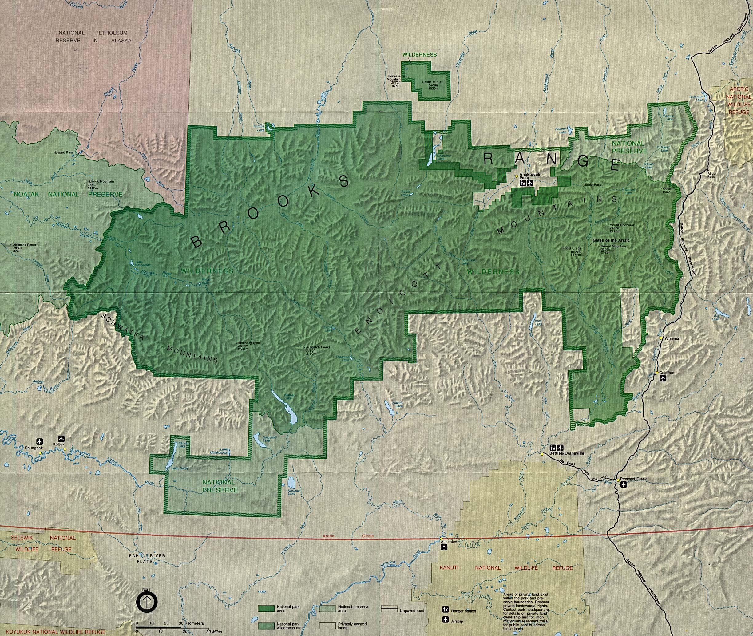
- Gates of the Arctic National Park and Preserve in Brooks Range – (PDF)
- Gates of the Arctic National Park and Preserve in Brooks Range – Preserve Area – (click on the map to enlarge)
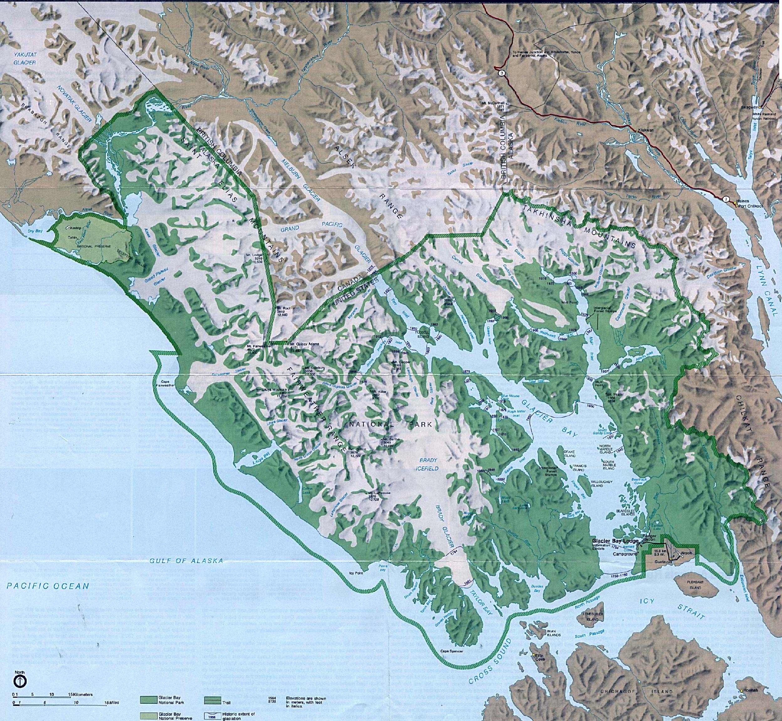
- Glacier Bay National Park – (click on the map to enlarge)
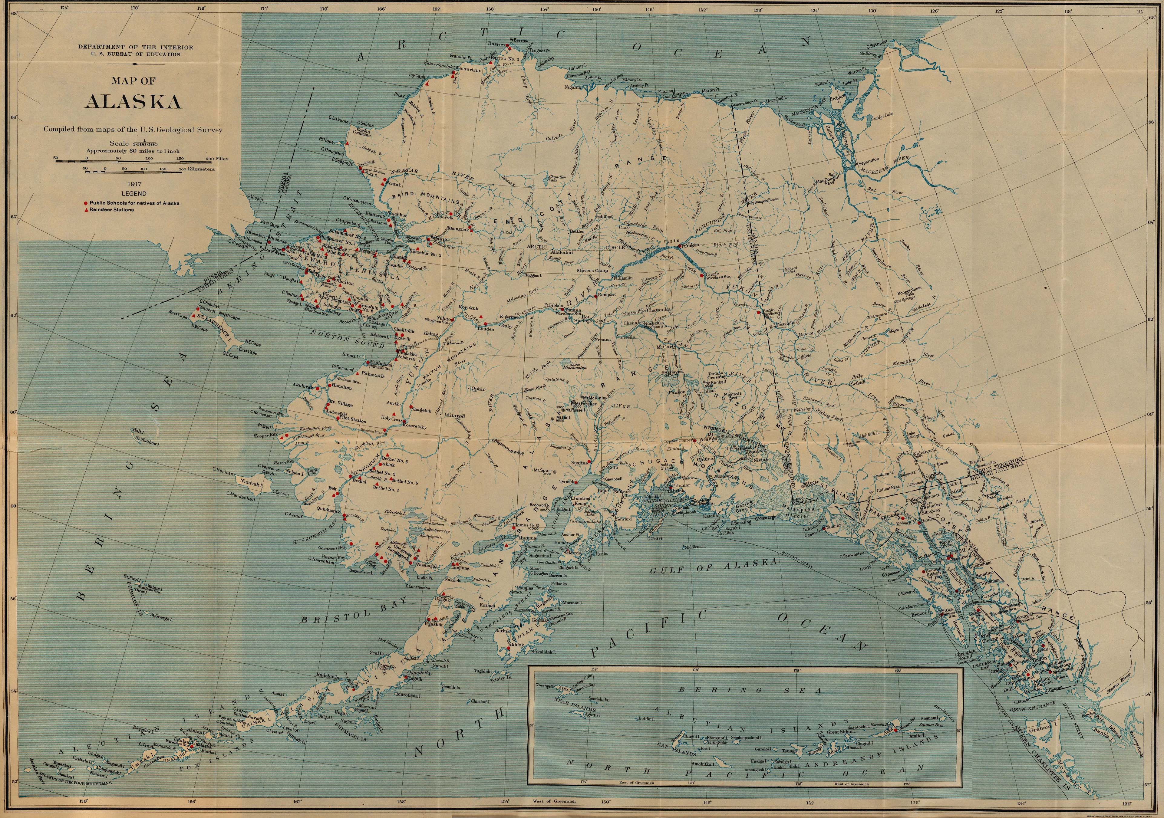
- Historical (1917 – click on the map to enlarge)
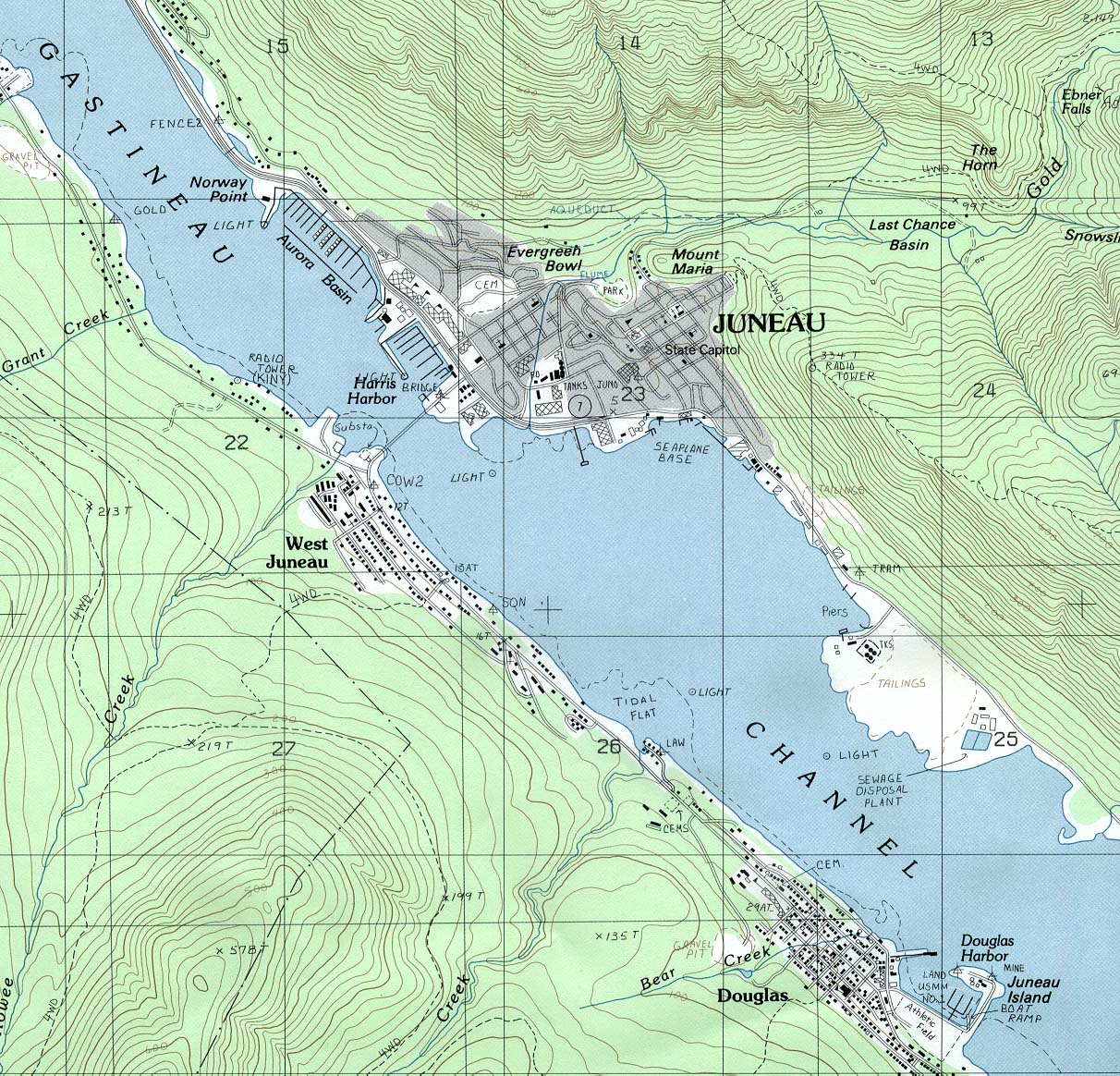
- Juneau (topo map – click on the map to enlarge)
- Katmai National Park and Preserve – (click on the map to enlarge)
- Kenai Fjords National Park – (PDF)
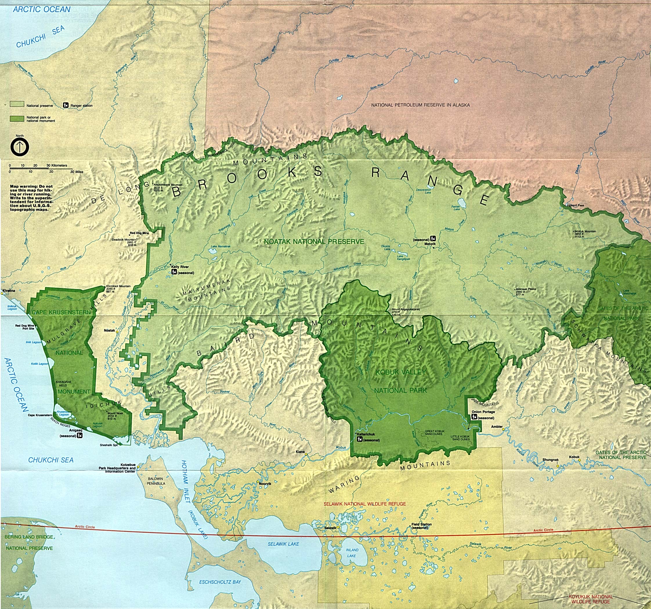
- Kobuk Valley National Park – (click on the map to enlarge)
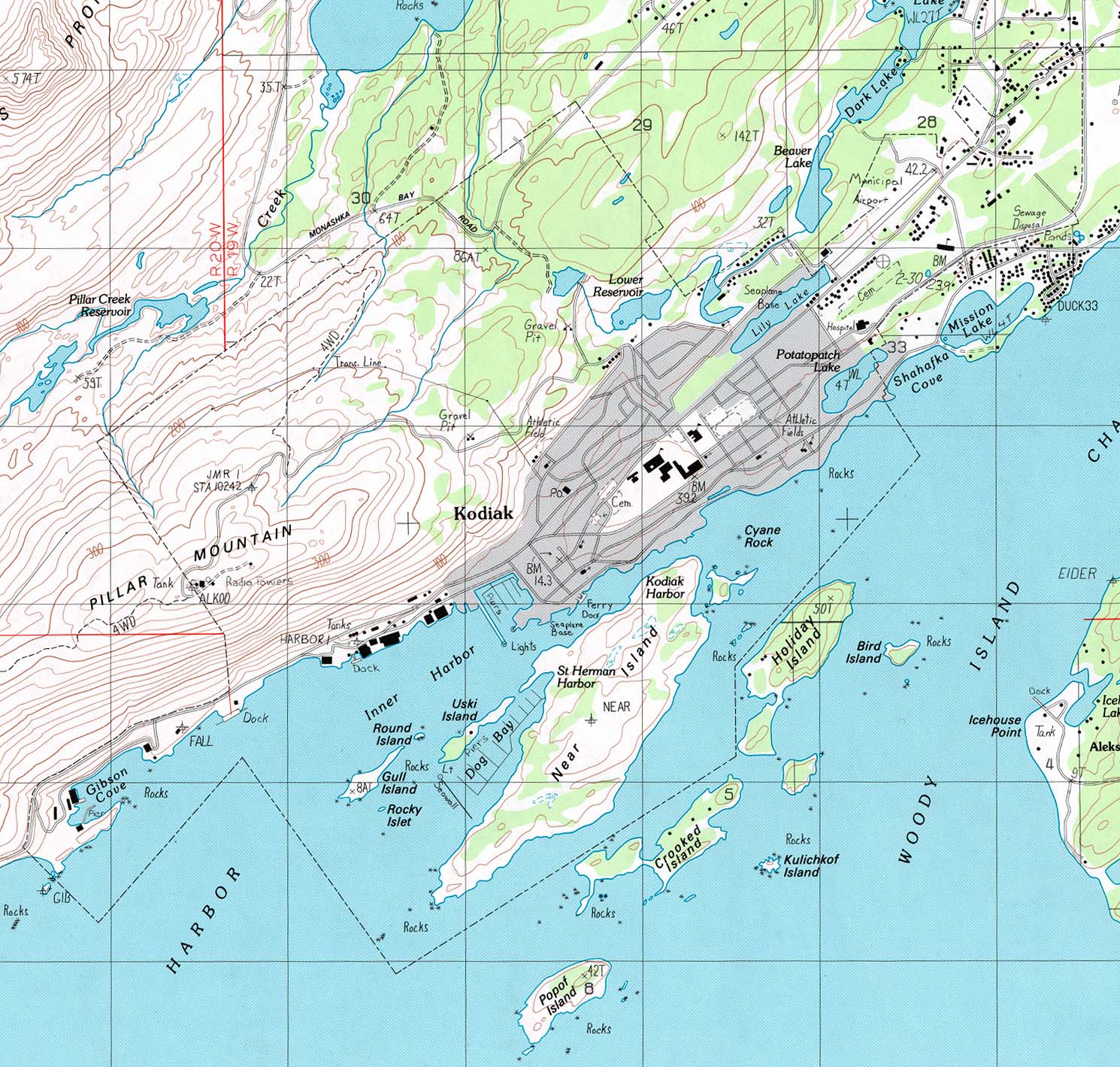
- Kodiak (topo map – click on the map to enlarge)
- Noatak National Preserve – (click on the map to enlarge)
- Political Base Map (click on the map to enlarge)
- Political, Detailed – Aleutian Islands
- Political, Detailed – Anchorage and the Kenai Peninsula
- Political, Detailed – Most of the state
- Political, Detailed – Southeast panhandle
- Political, Detailed – West coast
- Shaded Relief A very detailed map (click on the map to enlarge).
- Shaded Relief – Another good choice.
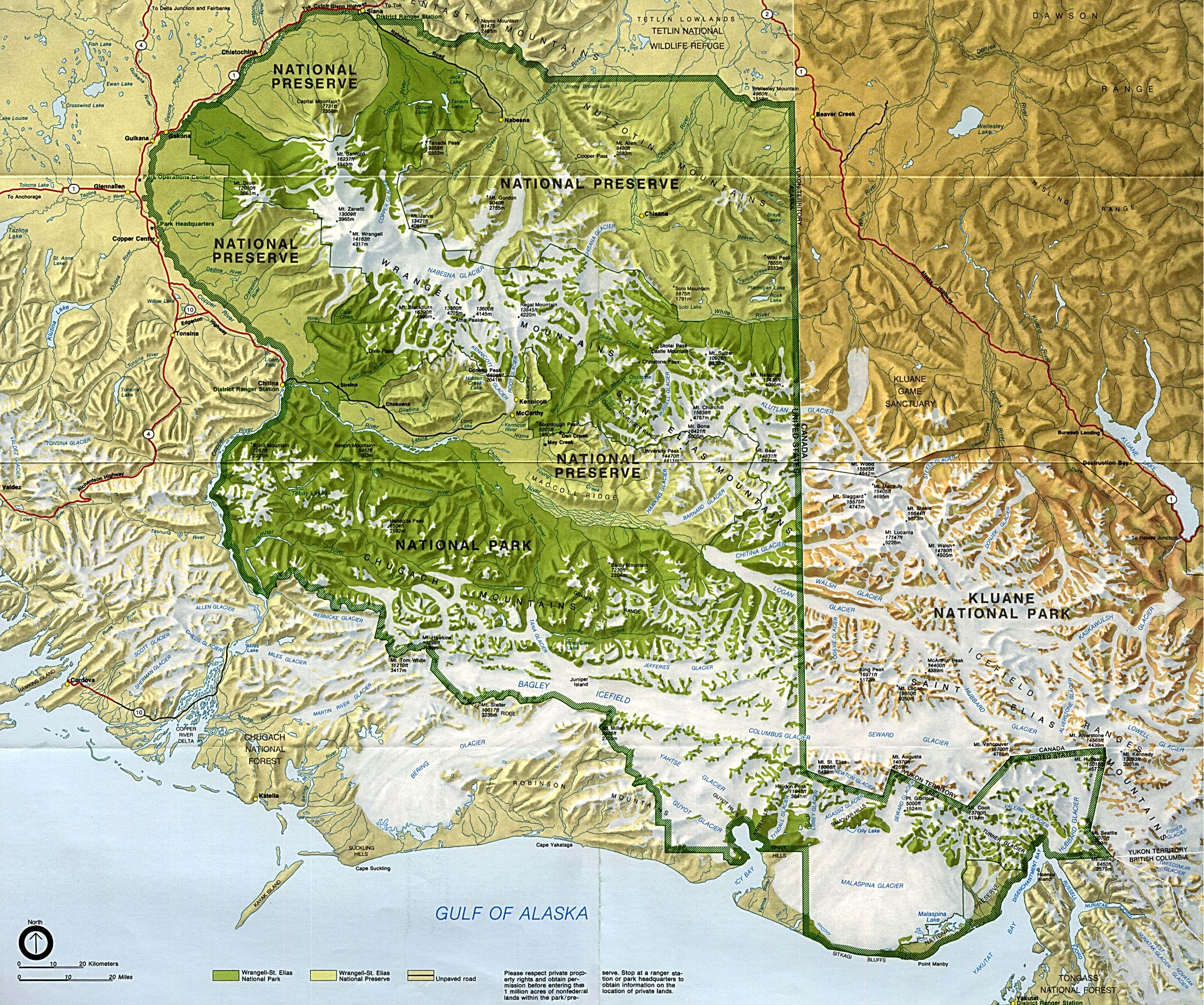
- Wrangell-St. Elias National Park and Preserve (click on the map to enlarge)
- Yukon – Charley Rivers National Preserve – (PDF)
- Alaska Map – Shows the entire state of Alaska (PDF)
- Central Alaska – More detailed view of the part of Alaska covered by most land tours, with Anchorage at its center
- Central Alaska Transportation Map – (PDF)
- Central Kenai Peninsula Map – Covers key sights and hiking trails between Anchorage and Seward
- Turnagain Arm Driving Map – (PDF)
- Portage Valley & Whittier Map – A map of the route from Anchorage to Fairbanks (PDF)
- Anchorage to Homer Driving Map – Shows top sights along the drive.
- Anchorage to Seward Driving Map – Shows top sights along the drive.
- Anchorage to Fairbanks Driving Map – Shows top sights along the drive.
- Anchorage: Coastal Trail Map – (PDF)
- Anchorage: Kincaid Park Trail Map – (PDF)
- Anchorage: Hillside Trails Map
- Anchorage Area Map – (PDF)
- Anchorage Downtown Walking Tour Map – Walking tour highlights are described and illustrated. (PDF)
- Denali National Park Road Map – (PDF)
- Fairbanks Alaska Area Map
- Fairbanks Downtown Map – (PDF)
- Girdwood Downtown Map – (PDF)
- Homer Alaska Area Map – (PDF)
- Seward Alaska Area Map – (PDF)
- Talkeetna Alaska Map – (PDF)
- Valdez Alaska Map – (PDF)
Downloadable
- Blank Outline Map – A printer-friendly document.
- Roads – You can zoom in and print your own maps at a large scale.
- Shaded Relief – Print out the whole state or zoom in and print a selected portion.
For purchase
- Alaska – An information-rich tear-proof laminated folding highway map.
- Alaska Wall Map – Colorful shaded relief and elevation.
- National Geographic’s Nat’l Park CD-ROM, Nat’l Parks of Alaska – Detailed interactive topo maps on CD ROM – includes hiking trail information.
- Click here for other Alaska maps
Alaska Of Interest

Russia invaded the territory now known as Alaska in 1741 and decimated much of the native population. The Russian Czar’s rule eventually weakened and Alaska became a territory of the United States on March 30, 1867, with the purchase price of $7.2 million. Most Americans thought of it as a frozen wasteland. One journalist was quoted as saying “The mystery is not why Russia wished to sell Alaska but why the United States wanted to buy.”
Alaska is the only U. S. state to extend into the Eastern Hemisphere and has the highest mountain in North America, Mt. McKinley. It is the largest of all the states, being one-fifth as large as all the other states combined and it lays claim to the nation’s largest area of forest.
Alaska is the leader in the U.S. for commercial fishing catch — mainly salmon, halibut, herring, crab, shrimp, and cod. Anchorage is the major fishing port, and the freezing and canning of fish makes up the bulk of the food-processing industry, the state’s largest manufacturing sector. Mining is the state’s most valuable industry and it is chiefly of petroleum and natural gas. Timber is of great importance, although questions over logging in the state’s national forests are brought up constantly. A main cause for settlement near the end of the 19th century, gold is no longer mined in great quantities. Fur-trapping, Alaska’s oldest industry, survives and pelts are obtained from many different animals.
See related information at United States Maps
Browse all the other World Maps.