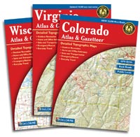
Have you ever needed to see back roads and land features for your entire state? Topo map books are available for all 50 states. Each book covers an individual state in its entirety, with these exceptions: Connecticut and Rhode Island are combined and Maryland and Delaware are combined. Northern California is a separate book and Southern & Central California are another book.
Each book is made up of quadrangular maps covering the entire state. The scale of most of the topo map books is 1:150,000. That means that one unit on the map equals 150,000 units on the ground. Each map page is composed of approximately 1/2 degree longitude by 1/2 degree latitude, covering an area of approximately 25 miles wide by 30 miles high. These figures vary somewhat from state to state.
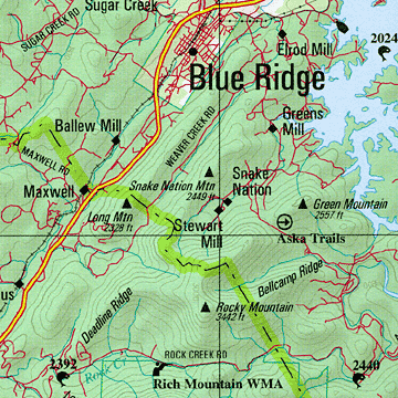
A sample from the Georgia topo map book.
Grid System and Index
For locating placenames and map features, the maps are divided into rectangular sections, defined by intersecting grid lines and identified by coordinates along the sides and top of each page. All Index and Gazetteer listings include page numbers and coordinates utilizing the grid system.
The Index of Placenames and Map Features includes all placenames, geographic features, outdoor recreational facilities, airports, colleges/universities and other points of interest found on the maps. The books also include lists of attractions, campgrounds, fishing spots, golf courses, historic sites, hunting areas, scenic drives, trails, and unique natural features.
Orientation
The sides of the maps are aligned with true north/south. The tops and bottoms run true east/west. When using a compass to orient maps to actual field location, remember that magnetic north may be different from true north. (See magnetic declination) When using topo map books in a vehicle, you may want to orient the maps to the direction of travel. Although the book will be upside down when traveling due south, reading it in this position may be easier than transposing left and right turns.
GPS Users’ Information
To aid in using GPS positional data, each state map in the book includes tick marks and grid lines along the top, side and bottom of each page. The tick marks show latitude and longitude at 1-minute intervals. Where space allows, the longitudinal grid lines are labeled at 6-minute intervals and the latitudinal grid lines are labeled at 4-minute-and-22.5-second intervals. The grid lines are referenced in both conventional and decimal forms; the outer corners of each state map are only referenced with conventional coordinates. The tick marks and the grid lines represent the World Geodetic System (WGS84) datum.
Who Publishes the Topo Map Books?
DeLorme is the company that produces the topo map books. The books are officially known as the Atlas & Gazetteer. DeLorme has been in business since 1976 and as an indication of the quality they embrace, the following is included in each Atlas & Gazetteer: “Should you find conditions other than as shown on the maps, we would appreciate hearing about them. Trace a few key features from the map in question and then add your proposed changes. Or contact us and we will mail you a working copy of the map on which to write your notes.”
“For more details than you can ever use in one lifetime, the DeLorme series of Atlas & Gazetteer maps are absolutely the best thing going. They combine the detail of a U.S. Geological Survey topographic map with the convenient packaging of a conventional road atlas.” – San Francisco Chronicle
Each atlas is paperback; size 11″ x 15-1/2″
I currently have 26 of these books – there are no other map books like these and I automatically buy one for every new state I visit.
Click on a state below to shop for the DeLorme topo map book.
Links open in a new window.