For the best quality as far as resolution and detail in topo maps, individual USGS maps may be the way to go. We say “may be” because topo maps printed from a CD can rival the individual published quads. The quality depends significantly on the type and quality of the printer and paper. For more information on topo maps on CD, click here.
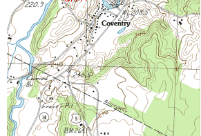
Topo quadrangles are most commonly available in scales of 1:24,000, 1:100,000, and 1:250,000. The largest scale is 1:24,000, which means 2000 feet on the ground equals one inch on the map. This scale even shows individual buildings and houses in many cases. The following table gives the details for each series.
| Scale | 1:24,000 | 1:100,000 | 1:250,000 |
|---|---|---|---|
| One inch represents | 2000 ft. | about 1.5 miles | about 4 miles |
| Standard Quadrangle Size | 7.5 x 7.5 minutes | 30 min. x 1 degree | 1 degree x 2 degrees |
| Quadrangle Area (Square Miles) | 49 to 71 | 1145 to 2167 | 4580 to 8669 |
| Map Size | 22″ x 27″ | 29″ x 44″ | 22″ x 32″ |
Information in the border (sometimes called the collar) of USGS maps include lines of latitude and longitude (in degrees, minutes, and seconds), date published, scales, and magnetic declination.
Degrees, Minutes, and Seconds
You probably know that latitude (the lines circling the earth that are parallel to the equator) and longitude (the lines circling the earth that pass through the poles) are measured in degrees. And you probably also know that there are 360 degrees in a circle. Degrees are divided into units known as minutes. Each degree has 60 minutes. For very precise plotting or navigation, each minute is further divided into seconds and each minute has 60 seconds.
Magnetic Declination (Also known as Magnetic Variation)
The north that a compass points to (magnetic north) is usually not true north. Magnetic declination is the difference, given in degrees, between where a compass points and true north. Magnetic north is always changing slightly.
Generally, the magnetic declination can vary anywhere from zero to about twenty degrees, the line of zero degrees being roughly along the Mississippi River, and twenty degrees at the extremes of the states of Maine and Washington. USGS maps have the magnetic declination diagrammed on each topo quadrangle.
Anywhere east of the line of zero magnetic declination, the compass will point to the left, or west, of true north. Therefore, you will need to add the amount of declination to your compass reading for the correct bearing. Conversely, anywhere west of the line of zero declinaton, you would subtract for the correct bearing.
Where to Buy
You can buy USGS maps (topos) at AdventureStation.com. However, a better way to go is to order custom topo maps centered on any location. Because you’re not limited to pre-published maps, you could save a lot of money by needing only one map instead of 2 or 4. AdventureStation custom topo maps are the same price as USGS quads, plus they are printed on waterproof, tear-resistant paper. For more information on custom topo maps, click here.
AdventureStation.com also has several choices of sizes suited to either field use or reference and wall maps. The larger maps can be ordered laminated with protective UV resistant plastic.
Return to Topo Home.